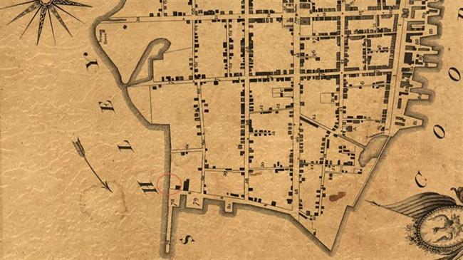
08. Gibbes Battery 1780
Named for its location near William Gibbes' wharf, Gibbes Battery was one in a belt of waterfront fortifications "formed of earth and palmetto wood, judiciously placed and mounted with heavy cannon.” These defensive works were constructed early in 1780, when Charleston awaited the British attack. Between February and April 1780, Archibald Gamble was a manager on the public works, improving the defensive line facing the Ashley River. From the "French Battery on Gibbs Wharf" to the Sugar House Battery on Savage's Green, his men cut a wet ditch 12' wide with a regular glacis [a slope in front of the fortification], and a range of oblique pickets in front of the old line. General William Moultrie detailed the number of cannon and other guns in Charleston's batteries on the day of surrender, May 12, 1780. In ten waterfront fortifications were ninety-five guns, seven of them at Gibbs Wharf. Borick, Carl P. A Gallant Defense, The Siege of Charleston, 1780. University of South Carolina Press, 2003.
|

 GibbesBattery1780_650x650.jpg)